21 March 2026 · Bruce Hearder · 12 min read
location-researchWhy Old Workings Are The Best Prospecting Ground In WA — And Why Most Prospectors Are Reading Them Wrong
Most prospectors treat old workings like a consolation prize. Someone else's leftovers. You'll swing the nearest mullock heap, run a quick grid over the disturbed ground, pull nothing, and wander back to the car wondering if the old-timers cleaned the place out a century ago.
Here's the thing though — that thinking is completely back-to-front.
An old working isn't a hole where the gold used to be. It's a hundred-year-old geological survey. Those men who dug it were very good at what they did. They spent their careers following gold through country that would make your eyes water. But they were working blind from the waist down, they stopped when their arms gave out, and when the water came in, that was it — tools down, move on. The gold they left behind isn't randomly scattered. It follows rules — geological rules that haven't changed since those shafts were sunk.
This article is about how to read those rules.
Read the Whole System Before You Swing a Coil
This is the one that gets people every time, and I'll be honest — I've made this mistake myself early on.
A single shaft tells you almost nothing on its own. But a shaft, a costean, a drive direction, and a mullock heap together? That's a story. Those features, taken as a system, tell you exactly what the old-timers thought they were chasing, where they were heading — and critically, where they stopped. That stopping point is the most important piece of information on the entire site.
Before you unpack the detector, spend twenty minutes walking the whole system. I know it feels like you're burning daylight, but this is the research that makes the detecting productive. What direction were they working? Were they following a reef strike or chasing alluvial gold? Where's the last disturbance in each direction?
That last point of digging is almost always the most productive place for a modern prospector to start.
Now, there are two completely different types of workings, and they require completely different strategies — and I see people confuse them all the time.
Reef workings — your shafts, drives, and costeans following a lode structure — tell you there was primary gold in a specific geological contact. Your job on a reef system is to find where that contact goes beyond what they worked. The reef didn't stop at the last shaft collar. It kept going. They just couldn't follow it anymore.
Alluvial workings — races, paddocks, sluiced ground — tell you that water was transporting gold from somewhere uphill. Your job on an alluvial system is different: find the source, or find the patches they missed between the payable runs.
Don't mix the two up. They need different approaches and, honestly, different detector settings.
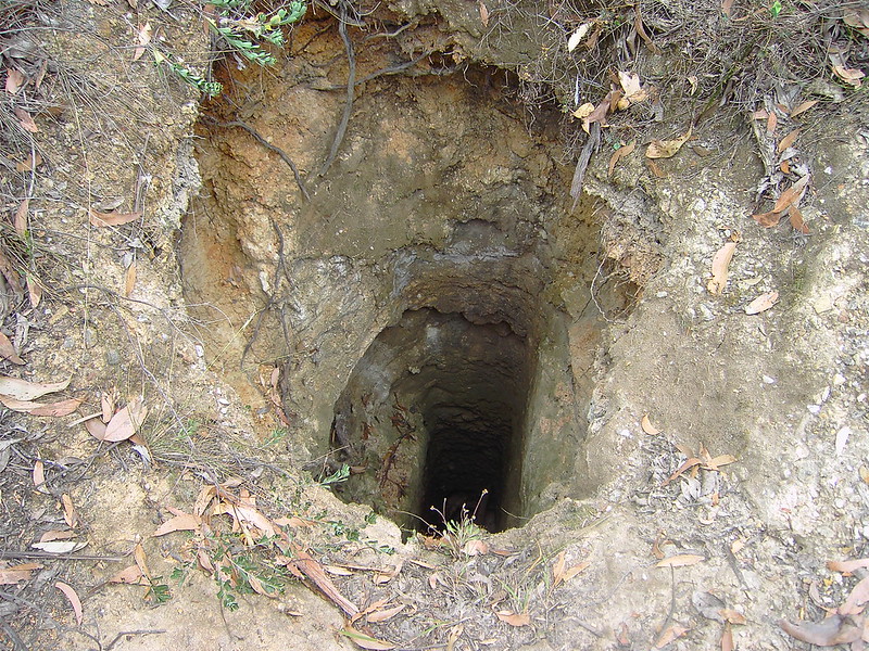
One practical note worth weaving in here: walk the entire site perimeter before you put your headphones on. Not just to be careful, although that matters too — old shaft collars look solid and the timber below them is 120 years old, so treat a two-metre radius around any shaft as compromised ground until you've had a proper look. The reason to walk first is operational. Once your eyes are down and your ears are full of headphone static, you need to already know where every hazard is. Every time you change direction, do a visual sweep. Your ears are occupied — your eyes have to pick up the slack.
The Four Reasons They Stopped — And What Each One Means For You
The old-timers weren't incompetent. They were constrained. Understanding which constraint stopped them tells you exactly what kind of gold is left and how to go after it.
Reason one: technology. Hand tools and early hard-rock methods couldn't detect dispersed gold in low-grade material. Anything that wasn't in a visible reef or heavy alluvial concentration just didn't register as worth working. A modern PI detector reads ground those men would have considered completely barren. The shallow fringe around any reef working — the disseminated gold in the wall rock either side of the vein — was never worth their time. It's absolutely worth yours.
Reason two: economics. When the gold price dropped or the costs rose, marginal ground got abandoned fast. And this is an important distinction: there's a difference between "this ground ran out of gold" and "this ground stopped making economic sense in 1903." Those are very different situations, and the historical records will tell you which one you're dealing with. If a mine closed because the gold price crashed, that reef is still in there. It didn't go anywhere.
Reason three: water. The water table was a hard physical limit for hand-pumping operations. Anything below it was unreachable — full stop. This creates a specific and repeatable opportunity. The ground around a shaft collar at the water table depth often has gold-bearing material that was exposed during sinking, then abandoned when the water came in. That material has been sitting there weathering and concentrating ever since. It's detectable now in a way it simply wasn't then.
Reason four: the supergene zone. This one gets a bit technical, but stick with me — it's worth understanding. Gold concentrates near the surface through a process called supergene enrichment. Basically, weathering breaks down the sulphide minerals in a reef and reconcentrates gold in the top twenty to forty metres of the profile. Old-timers would sometimes work through this zone chasing the primary reef below, not fully exploiting the coarse gold sitting in the saprolite — that crumbly, decomposed rock just above the fresh rock. Classic old-school oversight. Coarse, detectable gold in a zone they walked straight through.
When you're reviewing a site, try to identify why it was abandoned. If it's in the records, even better. "Water" and "insufficient capital" are your two favourite words to find. "Reef pinched out" or "gold values declined at depth" means more caution is warranted.
What the Mullock Heap Is Actually Telling You
Here's something most recreational prospectors miss entirely: the mullock heap is a free geological sample. Everything the miners pulled from underground is sitting right there on the surface, roughly sorted by depth. You don't need to analyse it in a lab — you need to read it. Two things matter: what the rock looks like, and whether it changes across the heap.
Three indicators to focus on:
Iron staining. Red, brown, and orange-stained rock means the original sulphide minerals have oxidised. This is the geochemical signature that carries gold in WA greenstone terrain — and once you've seen it a few times, you recognise it immediately. More staining equals closer to the mineralised zone. If one corner of the heap has noticeably more iron staining than the rest, that's the direction the reef was trending. You've just been handed a vector.
Quartz character. Not all quartz is equal, and this is something that took me a while to properly internalise. Grey, glassy, or iron-stained quartz is far more interesting than fresh white quartz. Vuggy quartz — the stuff with little holes and cavities — is where gold likes to hide. Ribbon quartz, thin wavy bands running through darker rock, often marks a shear zone, and shear zones are gold traps. If you're picking up pieces of ribbon quartz from a mullock heap, you're standing on a reef system worth understanding properly.
Host rock type changes. If the rock in the heap shifts from one lithology to another — say, from fresh greenstone to more silicified, veiny material — you're seeing a geological contact. And contacts are exactly where gold concentrates. Mark where on the heap that change occurs and extend it outward. That's your target zone.
Spend ten minutes walking the heap and handling rocks from different spots, not just whatever's on the surface. Look for where the character changes. GPS that direction. That's your vector for where to focus the detecting effort.
The common mistake here? People detect the heap looking for gold in the discarded rock. Some is there, yes. But that's not the point. The heap's real value is geological intelligence, not metal content. Read it first. Then detect the ground around it based on what you've learned.
Detecting the Extensions — Where and How
Here's the core principle that changes everything once you get it: the productive zone for a modern prospector is almost always beyond the old workings, not inside them.
On a reef system, extend the mineralised contact in both directions past the last disturbance. On an alluvial system, look for undisturbed ground between paddocks and work uphill from the deepest workings toward the source material.
Three specific zones that consistently produce results on old workings sites:
The shaft collar fringe. Within ten metres of a shaft, the ground was disturbed but never systematically detected. Old waste material, collapsed timber sets, surface gold that vibrated loose during blasting — all of it potentially still there. Work this ground carefully with a smaller coil.
The base and walls of costeans. Old-timers cut costeans — those long, straight trenches — to expose the reef at surface. They took the obviously payable bits and moved on. The base of a costean is fresh exposed rock that, in many cases, has genuinely never had a coil run over it. Work it slowly. This is some of the best undetected ground on any old reef site.
The perpendicular splays. Reef structures branch. The main drive followed the primary reef, but minor splays running off at angles — sometimes only a metre or two wide — were never followed. These require a small coil and patience, but they're real targets. A branch reef can carry just as much gold as the main lode, sometimes more, because the branching often happens at the same structural sites that trap gold in the first place.
Practically speaking: use a small concentric or DD coil around shaft collars and in tight costean bases. A large monoloop will saturate in variable ground conditions around old workings. GPS-track every run so you're not doubling up on ground you've already covered. Grid the clear ground extending along the reef strike to at least a hundred metres beyond the last disturbance in each direction before you write the system off.
And avoid the expanding-circles approach from the centre of the workings. Old workings have a direction. Follow the structure, not the geometry.
What the Historical Records Are Actually Worth
WA has one of the best publicly accessible mining history archives in the world, and most recreational prospectors use about ten percent of what's on offer.
The two key databases are WAMEX — exploration reports and historical mine records — and MINEDEX, which holds production data and tenement history. Both are free, both are online, and both are genuinely underused. But the real gem that almost nobody talks about is the Annual Reports of the Department of Mines. Government geologists walked these goldfields in the early 1900s and wrote detailed field descriptions that are still geologically accurate today. The rocks haven't moved.
When you open any historical record, there are four things to hunt for, in this order:
First: why was it abandoned? This is the single most important question. Everything else flows from the answer.
Second: how much came out, and from what depth? Shallow production tells you the supergene zone was being worked and there may be primary reef below that was never properly touched.
Third: what direction was the reef trending, and how far was it traced? This tells you how far the extensions might run and which direction is most worth walking.
Fourth: any mentions of "unpayable" sections or "patchy values"? Patchy ground on a reef system is a detector target. The high-grade patches they found were separated by lower-grade material they moved through quickly — material that's absolutely worth running a coil over today.
When you open a WAMEX report, go straight to the conclusion and recommendations section first. Government geologists in 1920 who wrote "further work warranted on the northwest extension of the reef" were very often right. And that northwest extension has probably never been detected. Cross-reference the reported reef direction against a topographic map and see if there's a surface expression you can put boots on.
Don't dismiss old reports because the language is archaic or the maps are rough. A field note from 1908 reading "rich patches of coarse gold in decomposed greenstone adjacent to a NNW-trending quartz reef, abandoned due to influx of water at 18 fathoms" is better intelligence than anything you'll find on a prospecting forum today. That reef is still trending NNW. It has been the whole time.
Putting It All Together
Old workings are the highest-probability prospecting ground in WA — not despite being previously worked, but because they've been previously worked. Someone already did the hard work of finding the gold system. They proved it. The question isn't whether the gold was there. The question is whether their technology, economics, and physics left any of it for you.
Almost always, they did.
The process is simple, even if it takes some practice: read the system before you swing. Understand why they stopped. Work the extensions, not the middle. Let the mullock heap point you in the right direction. And use the historical record — it's free, it's detailed, and the ground it describes has been sitting there waiting for a modern detector and someone willing to do a bit of homework.
The next step is figuring out which old workings in your area are on ground you can legally access, and which ones have the geological and historical record that actually justifies the drive. That's what I've built GoldProspectingWA.com for — historical tenement data, soil sample results, drilling records, all on one map, updated daily, so you can do this research at home before you pack the car. Head over and have a look around.
The ground is out there. Go find it.
Bruce is a former exploration geologist with thirty years of experience in Western Australia. He runs The Part-Time Prospector YouTube channel and GoldProspectingWA.com.